Ukrnafta is conducting large-scale seismic surveys using 3D technology.
The research area in the West is 77 square kilometers. It utilizes advanced technological equipment - a wireless system with almost 19 thousand accelerometer sensors operating simultaneously.
In the East, 98 square kilometers are being surveyed using a cable data logging system that includes 6,000 geophones (4,320 sensors are working simultaneously).
Due to challenging surface conditions on both sites - mountains in the West and wetlands, forests and rivers in the East - a combination of different types of sources, vibration and explosive, is employed to minimize the loss of primary information and achieve the best possible results.
In 2024, seismic surveys in the West are planned to cover 200 square kilometers in several license areas.
In the eastern region, 3D studies are planned for three fields with a total technological area of about 120 square kilometers.
Therefore, Ukrnafta's specialists will be able to create the most accurate geological models of the facilities and successfully drill new wells to increase extraction.
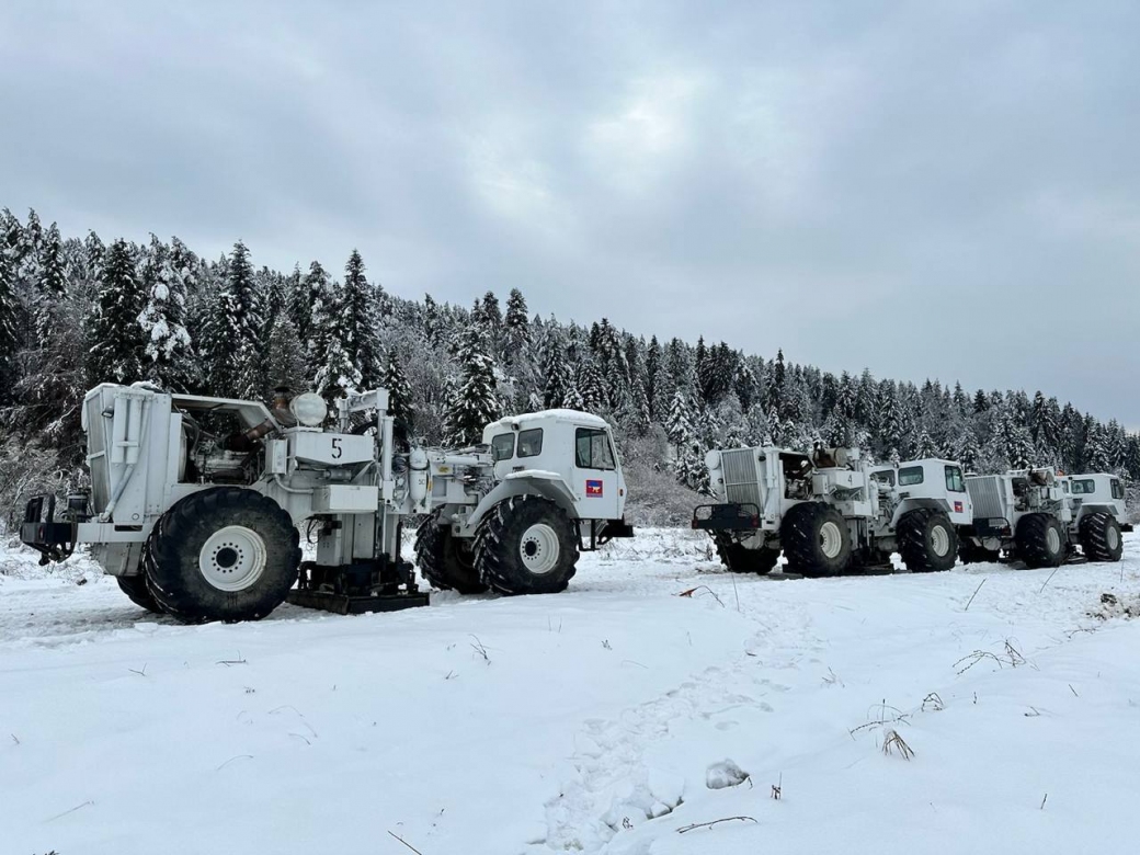
Conducting large-scale 3D seismic surveys
Also read